 vesseltracker.com
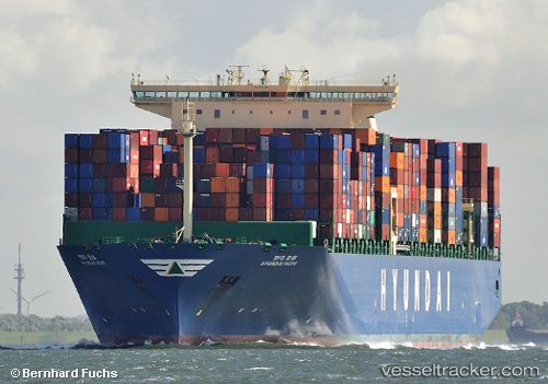
Vessel HYUNDAI HOPE IMO: 9637234, MMSI: 440176000 Container Ship
UTC, 41.01392, 143.02728, course: 211, speed: 11.9
UTC, 40.65569, 142.89723, course: 189, speed: 11.8
2026-03-05 21:40:02 UTC, 40.28713, 142.79132, course: 190, speed: 11.1
Live Vessel HYUNDAI HOPE Analytics (details, animations, etc.)
Live AIS position: UTC. 55 nm E of Hachimantai), updated 2026-03-05 21:40:02 UTC.Find the position of the vessel HYUNDAI HOPE on the map. The latter are known coordinates and path.
marine traffic ship tracker show on live map
The current position of vessel HYUNDAI HOPE is 40.28713 lat / 142.79132 lng. Updated: 2026-03-05 21:40:02 UTCCurrently sailing under the flag of Korea (Republic of)
HYUNDAI HOPE built in 2014 year
Deadweight:
145683 tDetails:
Last coordinates of the vessel:
UTC, 41.24700, 143.39246, course: 230, speed: 12.4UTC, 41.01392, 143.02728, course: 211, speed: 11.9
UTC, 40.65569, 142.89723, course: 189, speed: 11.8
2026-03-05 21:40:02 UTC, 40.28713, 142.79132, course: 190, speed: 11.1